Cartographies / Defence and Climate Observatory
30 November 2022
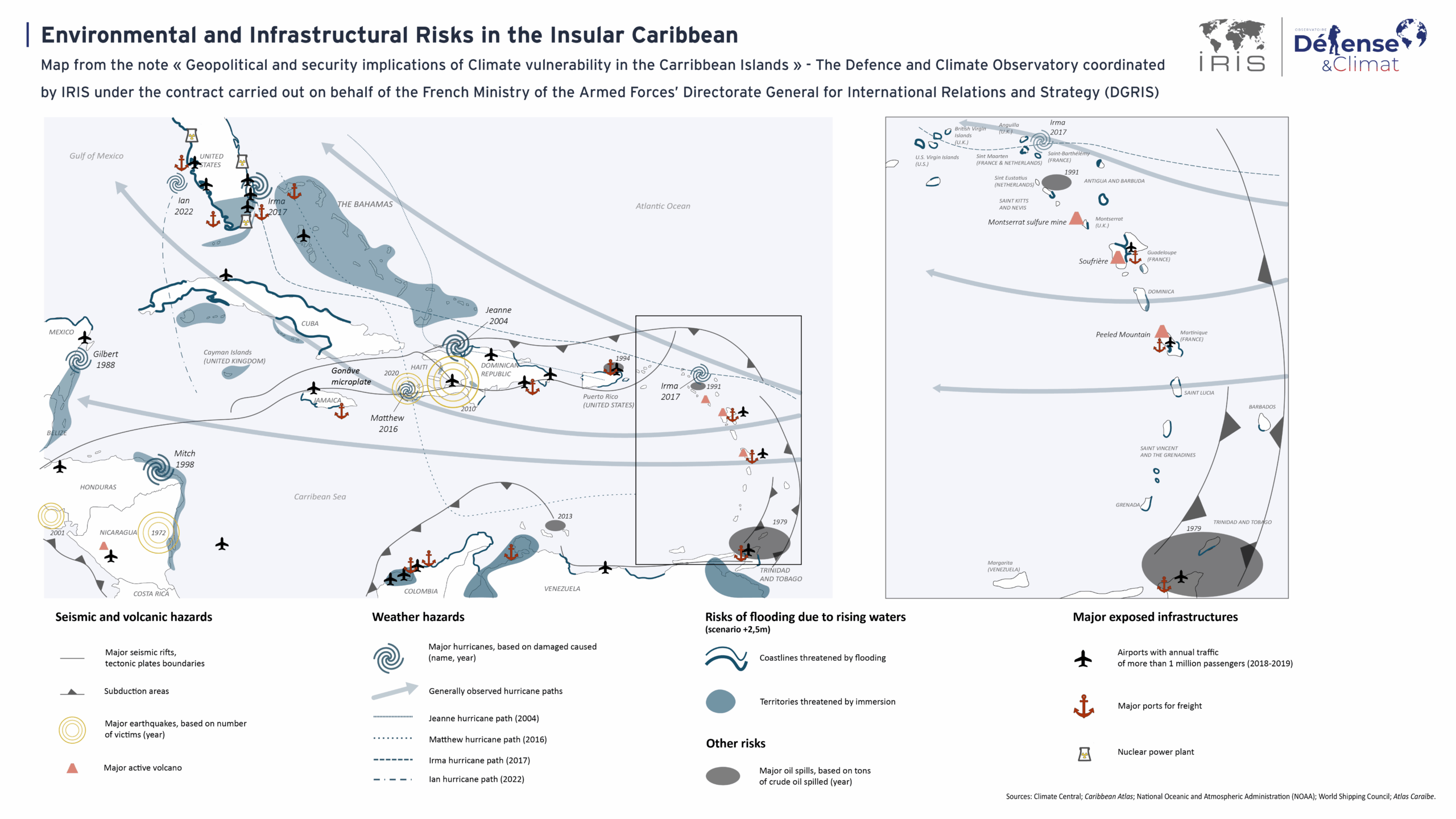
Environmental and Infrastructural Risks in the Insular Caribbean
-

Research Coordinator, IRIS
-

Special Advisor to the Director of IRIS
-

Head of editorial
The Caribbean region is characterised by its vulnerability to a number of natural and man-made phenomena, starting with a major seismic risk. It is located on several faults off the coast of Colombia and along the Antilles as far as Honduras, including major subduction zones and several active volcanoes. As a result, the Caribbean region regularly experiences destructive earthquakes, including the very deadly earthquake in Haiti in 2010. Added to this is a major meteorological risk, with regular hurricanes, generally tracking east-west towards Florida. Global warming is also increasing the risk of flooding in several low-lying areas in most of the coastal states and the Bahamas archipelago. Finally, oil spills with devastating effects on ecosystems add to the many destabilising factors for the region. As well as threatening people and ecosystems, these natural and human hazards also threaten a number of major infrastructures, including ports, nuclear power stations and airports.
This map is an excerpt from the note “What are the geopolitical and security implications of climate vulnerability in the insular Caribbean? published by IRIS’s Observatoire Défense et Climat on behalf of the French Ministry of Defence’s Directorate General for International Relations and Strategy (DGRIS).